The Nile River, a ribbon of life cutting through the African continent, has been a vital lifeline for civilizations since time immemorial. But how much do you really know about this mighty river’s path? This article will dive deep into the intricate details of the Nile River map in Africa.
From its humble beginnings in the highlands of East Africa to its grand finale in the Mediterranean Sea, the course of the Nile is a fascinating journey. It’s a tale of geographical wonders, historical intrigue, and a testament to the resilience of the human spirit.
Nile River Map Africa
Investigating the topography of the Nile River offers insights beyond mere geography. It provides an understanding of the river’s historical significance and modern applications that shape the landscape of Africa.
Historical Significance
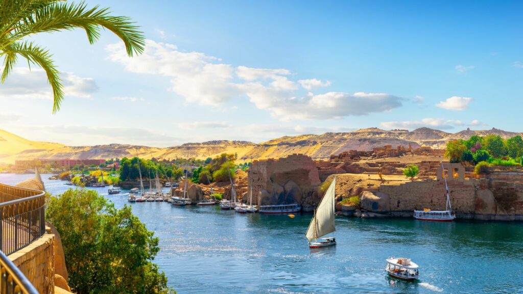
An analysis of the Nile River’s map underscores its historical importance. Thousands of years ago, ancient civilizations, such as the Egyptians, depended on this river. It acted as a life source, supplying sustenance and fostering growth. A glimpse at the map of the river reveals how these early settlements were strategically located along its fertile banks. Additionally, Kings used the Nile for sacred rites, employing its course to align their pyramids, exemplified by the Giza Pyramid complex.
Modern Application

Modern-day mapping of the Nile River also exhibits a multitude of applications. For instance, it serves as a powerful tool for city planning and irrigation project development. Agricultural sectors utilize these maps to trace the river’s most fertile routes, maximizing crop yield.
Additionally, energy industries harness the power of the Nile’s flow, shown in the strategic placements of dams such as the Aswan High Dam. Small-scale fishermen refer to this map for spots teeming with fish. Navigation enterprises use it to map out efficient trade routes, enhancing Africa’s intraregional and international trade.
Thus, mapping the Nile River, from a historical perspective to its current applications, forms an indispensable part of unraveling Africa’s past and charting its future trajectory. The article continues to delve deeper into each facet, providing a comprehensive journey along this monumental river.
Physical Attributes of the Nile River
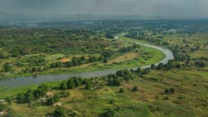
Panoramic scenes of the Nile are incomplete without a mention of its two noteworthy tributaries: the White Nile and the Blue Nile. The first, the White Nile, swells from Lake Victoria in Uganda, binding countries as it winds its way north. Contrastingly, the latter, the Blue Nile, takes birth from Lake Tana in the Ethiopian Highlands and is a crucial source of fertile silt.
Length and Flow
Regarded as one ofthe longest rivers globally, the Nile River stretches an impressive 4,135 miles from its southernmost stream’s source in East Africa to its northernmost outflow into the Mediterranean Sea. Its consistent northward flow, a result of the continent’s natural incline, ensures it maintains its characteristic unidirectional flow. The Nile River’s water volume varies seasonally, peaking in the rainy season with the flooding of its many tributaries.
Major Tributaries and Deltas
Once these tributaries’ journey concludes and the Nile meets the Mediterranean Sea, a remarkable delta spanning approximately 240 kilometres opens up at its mouth, creating a fertile floodplain. The resultant interplay between river and sea carves out a myriad of intricate waterways, marshes, lagoons, and sandbars within this sizable delta.
As testament to its historical significance, this delta has been the cradle of multiple thriving civilizations over millennia, leveraging the rich silt deposited by the river’s seasonal flooding.
Conclusion
The Nile River’s map isn’t just a geographical representation; it’s a testament to Africa’s rich history and a key to its future development. The river’s journey from East Africa to the Mediterranean Sea has been a catalyst for civilization growth, and the map reveals this in detail. The Nile’s strategic locations have fostered ancient civilizations and continue to influence modern city planning, agriculture, energy production, fishing, and trade. Its physical attributes, such as its length, tributaries and fertile delta, further underline its importance.